
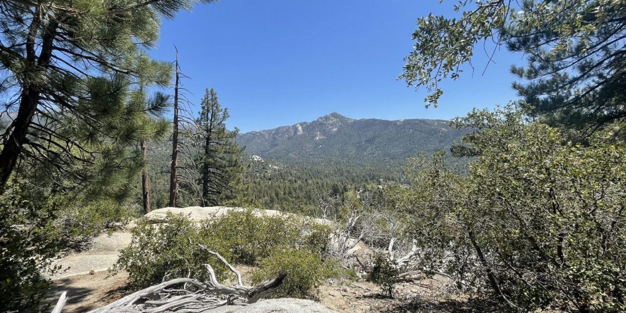
Idyllwild Perimeter Trail Offers Respite from Heat

The Idyllwild Perimeter Trail crosses Lily Creek, which flows off of Mount San Jacinto.
To escape the desert heat, smart hikers head to the mountains – which for Coachella Valley residents somewhere on Mounts San Jacinto or San Gorgonio. One such route where you can enjoy 70-degree temperatures is the Idyllwild Perimeter Trail.
The hike runs 3.3 miles in a loop. To enjoy those low temperatures, you’ll need to hike in the morning before 10:30 a.m., but if you start by 8 a.m., you should be able to knock out this short trail. Along the way, you’ll get to enjoy tall, aromatic pines, a creek, and fantastic views.
You can reach the trailhead by taking Calif. Hwy 74 (the Pines to Palms Highway) in Palm Desert south into the mountains. At Mountain Center, turn right/north onto Calif. Hwy. 243. Once in Idyllwild, go left/south to the Idyllwild Nature Center. Park at the first lot.
The trail heads either west or east from the entrance road. Go west or counterclockwise, if only because you’ll then do most of the ascent at the hike’s beginning. There are plenty of crisscrossing trails, so be sure to follow the signs or bring a trail map.
At about 0.1 miles in, the trail curves south and runs alongside Lily Creek. The trail flows off the side of Mount San Jacinto.
Along the way, you’ll reach the Yellow Pine Trail to about 0.2 miles. This heads to the nature center building. Continue right-straight/south.

The trail passes through a grove of manzanita with its striking red bark.
Most of the trail is shaded with pines. A manzanita grove adds visual variety. The manzanita shrub’s strikingly red branches usually reach about six feet. It begets small pink flowers in spring. Dozens of manzanita species exist, with some limited to very specific areas, such as Orange County or the Sonoma area.
At just under 0.3 miles, the trail crosses Lily Creek. It then climbs the side of a hill. Some maps show this part of this route as the Summit Trail.
You’ll get some nice vistas on the hilltop, which sits at about 5742 feet elevation. Mount Jacinto looms more than a mile above you to the northeast. The Desert Divide — the ridge of mountains with Palm Springs, Cathedral City and Palm Desert on the other side – stretches across the east.
From there, the trail descends the hill. At 0.8 miles, it reaches the Hillside Trail, which runs at the summit’s base.
There are plenty of large boulders to walk around along the trail, and even a couple you can scramble over. A few include bedrock mortars, or holes where Native Americans once ground corn and acorns for food.

Bedrock mortars used by the Cahuilla Indians can be found in boulders along the trail.
The trail next curves east, passing through the Idyllwild Park campground. As the route heads northeast, it reaches Lily Creek again.
Your best bet to see wildlife is near the stream. Mule deer, squirrels, and songbirds – especially juncos and the strikingly blue Stellar’s Jays – abound. Harmless lizards often can be spotted scampering about in the trail’s drier parts.
When the trail veers away from the stream, it crosses Riverside County Playground Road. Go left/west onto the road and follow it about a tenth of a mile, where the trail splits to the right/east.
Heading up the loop’s east side, the trail soon parallels the nature center’s entrance road before crossing it and returning you to your parked vehicle.
Leashed dogs are allowed on the trail. Be sure to carry water and bug spray.
To view the Idyllwild Perimeter Trail topo map, click here.