Cedar Springs Trail is more than a mile above sea level.
When the desert floor begins to broil in summer heat, the best way for hikers to cool off is to gain some elevation. One great destination is Palm View Peak in the San Jacinto Mountains.
The 6.1-mile round trip Cedar Springs Trail (aka as Trail 4E17 in U.S. Forest Service literature) heads along the wooded peak’s side to a great view of the Coachella Valley. It’s more than a mile above sea level.

The Cedar Springs Trail heads through woodlands atop the Desert Divide.
To reach the trailhead, from Calif. Hwy. 111 in Palm Desert, take Calif. Hwy. 74 south. After passing through Thomas Mountain, turn right/north onto Morris Ranch Road. The trailhead is in about 4 miles. Park well off the side of the road.
The trailhead is on private land – Camp Scherman, owned by the Girl Scouts of Orange County – so stay on the dirt road and don’t cross the fences. Close any gates behind you.
This hike initially runs through desert at 5760 feet elevation. Expect to see wildflowers blooming there following spring and summer rains.
In about 0.25 miles, the trail enters an oak grove and meadow with a couple of picnic tables. A dry creek runs alongside the area. At the hike’s end, this is a great spot to enjoy lunch before heading home.
Around 0.4 miles, the trail enter San Bernardino National Forest. For the rest of the way up, you’ll enjoy neat views of a side of the San Jacinto Mountains that can’t be seen from Coachella Valley. Little Desert Peak rises above the trail to the northwest with Bald Mountain behind it while Cone Peak is to the northwest.
The trail soon arrives at a series of switchbacks up the mountain side. Yucca lines the landscape.
Yucca can grow quite tall, reaching up to 9 feet high with a rosette of narrow leaves at its base. The shorter the plant, usually the younger it is.

Yucca lines part of the hillside as ascending to the Desert Divide.
Still, yucca often needs at least five years to reach maturity. When it does, the flowers are impressive, with hundreds of cream white to purplish bell-shaped flowers appearing on branches circling the main stalk. The flowers can stretch up to 27 inches from the stalk and taking up half of it length. They usually bloom in October.
After flowering, the yucca usually dies. Its roots can shoot up in other spots, however, forming several clones around it. Following a wildfire, the root even can grow up through its own stalk.
The yucca relies on the California yucca moth for pollination. In a classic example of symbiosis, the female moth lands on one flower and collects pollen then flits to another yucca’s flower, where she lays an egg and deposits the pollen. The pollinated yucca grows seeds that feed the larva hatched from the egg.
Along the switchbacks, the landscape around the trail increasingly grows more wooded. This is especially so where you cross an intermittent stream.
At 2.3 miles, the trail junctions with Pacific Crest Trail on the Desert Divide. You’re in a saddle at about 6800 feet elevation.
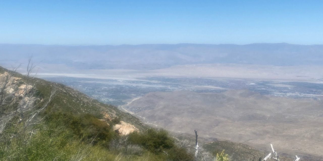
Continue straight/northeast. The trail descends, offering great views of the Coachella Valley. Palm View Peak rises to the west.
After passing through a tree grove, the ascends out of it to Cedar Springs, reaching it at 3.2 miles with about 1700 feet gained in elevation. Cedar Springs sits in a flat grove of pine, oak and cedar. It marks a good turnaround spot
Going down, you’ll enjoy great views of Garner Valley. Pyramid Peak is to the southeast next to the trail.
While much of the trail is shaded, it also gets the full brunt of the sun during the morning hours, so be sure to don sunscreen, sunglasses and sunhat as well as bring plenty of water. Dogs are allowed on the trail.
Image Sources
- 01-the-cedar-springs-trail-heads-through-woodlands-atop-the-desert-divide.: Rob bignell
- Yucca: Rob Bignell
- Great views of the Coachella Valley: Rob Bignell