Several minor mountain ranges divide Joshua Tree National Park into a series of desert basins.

Panorama Loop
The challenge of hiking the High Desert is the weather – summer is blistering and winter freezing unless you want to bundle up. There’s a narrow window in spring and autumn, however, when the weather reaches the Goldilocks zone – not too hot, not too cold, but just right. The High Desert around Joshua Tree National Park is closing in on that point.
Usually through February, highs at the national park reach the mid 60s, which is great sweatshirt weather hard to break a sweat in. That’s not just comfortable for clambering over the park’s giant boulders or hiking amid its vast Joshua tree forests, but for peakbagging – that is, ascending a mountainside to the summit.
Several minor mountain ranges divide Joshua Tree National Park into a series of desert basins. Though they appear desolate and foreboding in the hot sun, decades ago many miners often trudged about these ranges looking for gold, silver and other minerals that would make them rich men. Today, the rocky mountains offer the wealth of beautiful and spectacular vistas.
Here are the best trails to explore the park’s rugged mountains.
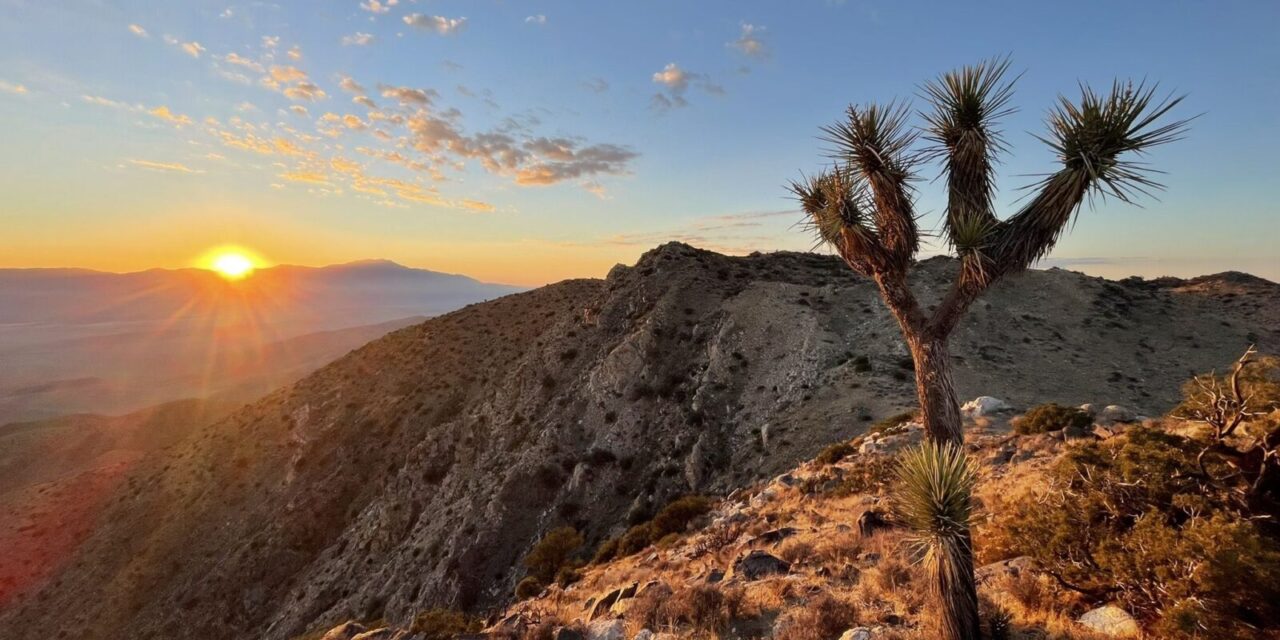
Inspiration Peak Trail
This 1.2-mile round trip hike from Keys View offers fantastic views of the Coachella Valley and the Salton Sea. The summit is at 5,550-feet.

Lost Horse Mine Loop Trail
Lost Horse Mine Loop
You’ll gain 550 feet in elevation an enjoy some great views of the basin below on this 6.5-mile loop. The trailhead is at the end of Lost Horse Mine Road, which branches from Keys View Road.
Mastodon Peak Trail
This 3-mile loop in the park’s southeastern section is perfect at sunset as the rocks glow orange in the dimming light. Reaching the craggy granite summit requires an off-trail rock scramble. The trailhead is in the Cottonwood Spring parking area with a 375-foot change in elevation; some maps refer to it as the Mastodon Mine Loop Trail.
Panorama Loop
The 6.6-mile trail gains 1,100 feet in elevation as heading up a wash the along a ridgeline in the Little San Bernardino Mountains, offering plenty of scenic views. Park at the Black Rock Nature Center.

Ryan Mountain Trail
Ryan Mountain Trail
An excellent spot to enjoy either sunrise or sunset, the trail runs three miles round trip to a 5,457-foot summit with 360-degree views. Along the 1050-foot climb, the Hall of Horrors rock area and Saddle Rock can be seen from above. The trailhead is off of Park Boulevard between Sheep Pass and Ryan campgrounds.
South Park Peak Trail
The O.6-mile loop heads up to a peak overlooking Yucca Valley with great views of Mt. San Gorgonio and San Jacinto Peak. The sunsets here are spectacular. Though technically not in the national park, it is accessed via the park’s Black Rock Canyon Campground.

Warren Peak Trail
Warren Peak Trail
The reward for this 6.2-miles round trip with 1,100 feet in elevation gain are the incredible views of San Jacinto Peak and Mt. San Gorgonio. During spring, the two peaks are snow-capped. Park at the Black Rock Nature Center.
Image Sources
- Inspiration Peak Trail: Rob Bignell