
Almost all of the Randall Henderson Trail is exposed to the sun
Day hikers can explore the foothills of the Santa Rosa Mountains on the Randall Henderson Trail.
Consisting of three stacked loops, the trail runs 2.4 miles and gains 425 feet in elevation just south of Palm Desert. The hike is best done October through April to avoid the summer heat.
To reach the trailhead, from Palm Desert, take Calif. Hwy. 74 (the Pines to Palms Highway) south into the mountains. Turn left/east into the National Monument Visitor Center. Park in the first (southernmost) lot rather than the one next to the visitor center. The trail leaves from the lot’s east side. You’re at about 980 feet above sea level.
The trail begins with a connector to the Wash Loop. At 0.06 miles, the connector reaches that loop; go left/northeast onto it.

A number of desert plants bloom during spring on the trail.
The flora is typical of that for the Colorado Desert, a subset of the Sonoran Desert that covers the Coachella Valley.
Creosote– the most common native plant in the Coachella Valley – dominates the route. An evergreen, it usually reaches a height between 3 to 9 feet high. Though it reproduces via seed, new shoots also can form from its roots, making it a clonal plant; the oldest known creosote is an estimated 11,000 years old.
Catclaw acacia also can be seen along the way. In ideal conditions, it can grow up to 12 feet high and 8 feet around. Its cream yellow flower usually blooms in mid-July. Hikers often call it the wait-a-minute bush, as its curved thorns will hook onto clothing when brushed against.
Several of the desert plants along the trail bloom during spring or of the winter is wet. Among them are: the beaver trail cactus, whose yellow and fuchsia flowers come out in mid-March; the red barrel cactus flower with its yellow petals and red centers in mid-spring; the chuparosa bush’s red tubular flowers in spring; fishhook cacti with their showy strawberry flowers in spring; and the mesquite’s yellow flowers in late spring.

Rare desert tortoises live alongside the trail.
The various flora provides food and shelter to many small animals and birds. Even in death, the cacti’s woody skeleton offers a home for such wildlife, especially lizards.
A number of small lizards can be spotted sunning themselves and darting about the trail. In addition to the cacti skeletons, many of the lizards live in underground dens, entered via the numerous holes you’ll see along the way.
The trail also skirts habitat for the endangered Peninsular bighorn sheep. To see them, you’ll need to look up at the ridge walls, where they step about small shelves in the cliff faces as easily as we amble down a sidewalk.
At 0.6 miles, the trail reaches the end of the northern leg of the Wash Loop. Continue left/east onto a leg of the Cholla Loop.
A number of granite rock formations line the route. The rock’s color depends on the mix of feldspar, mica and quartz so can range from extremely light to quite dark. Lichen often grows on these rocks, helping to break them down over the eons.
Not all of the “film” on the granite is lichen. The dark brown stuff is patina, a tarnish caused by oxidation when rocks are exposed to the open air over a lengthy period.
Along the high side of the Cholla Loop, you’ll be treated to some great views. Toro Peak looms ahead, rising 8,716 feet above sea level. It will be shrouded in snow during the trail’s hiking season. When you pause for a break, turn around; the Palm Desert and the Coachella Valley stretch out below you while Mt. San Jacinto rises to 10,834 feet in the southwest. One particularly spectacular view of Mt. San Jacinto is at sunset when it is framed in brilliant light.
Part of the Cholla Loop heads south on a dirt road. After a hairpin turn, it rambles across the top of the canyon. This offers some nice views of the eastern San Jacinto Mountains.
While looking up at the sights, be sure to glance down, too, lest you step on a desert tortoise. The endangered species once lived in the southern Coachella Valley, but their numbers are increasing near the trail. If you see one, keep your distance; they store their water in bladder canteens that release when scared. For the tortoise, this can lead to dehydration and death.

The foothills offer ideal growing conditions for teddy bear cholla.
Another thing to watch out for on the trail is teddy bear cholla. With seemingly fuzzy arms, they look adorable enough to cuddle, but barbed hooks sit on the end of their spines. They easily get caught on clothing and if hooked into your skin will be painful to remove. Because of this, small birds sometimes build nests in the teddy bear cholla to protect their young from predators.
Ocotillo is another plant along the trail that attracts birds. Hummingbirds and sparrows often will sit on the spindly plant’s branches, one of the few places they can rest off the ground in the desert.
At about 1 mile, the trail reaches the Canyon Loop. Go left/northeast onto it.
The trail then ascends the side of the foothill to a ridge then descends it toward Hwy. 74 and back down the wash.
At about 1.5 miles, you’ll reach the southern leg of the Cholla Loop. Go left/west onto it.

Randall Henderson Trail topo map
The trail is named for the former publisher/editor of Desert Magazine and desert explorer Randall Henderson, who helped found Palm Desert on several tracts of land he purchased during World War II. Among his early visions for the city was El Paseo, the Rodeo Drive of the Desert.
At about 1.7 miles, the trail reaches the southern leg of Wash Loop; go left/west onto it. Then at 2.34 miles, the trail arrives at the stem you walked in on, take it back to the parking lot.
Almost all of the trail is exposed to the sun, so be sure to don sunscreen, sunglasses and sunhat as well as bring water.
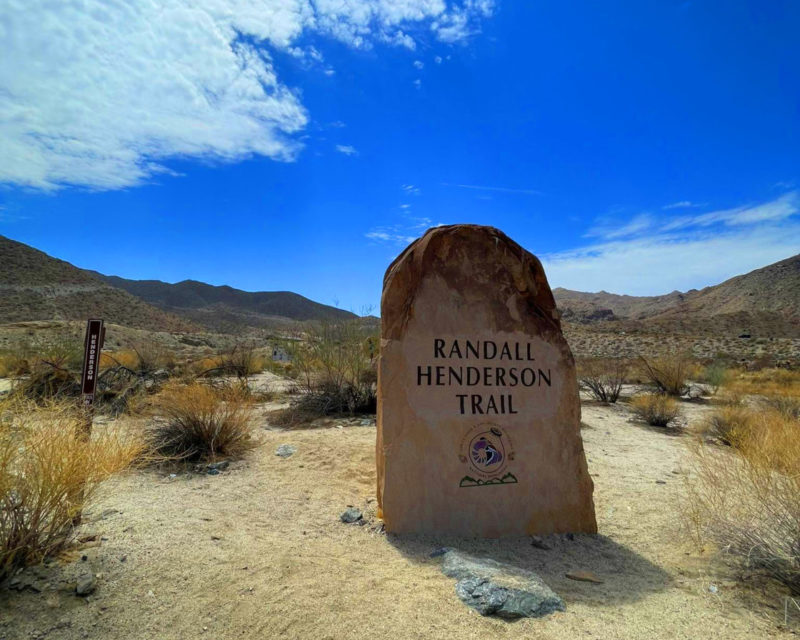
Photo caption above: The Randall Henderson Tail explores the foothills south of Palm Desert.
Image Sources
- The Randall Henderson Tail explores the foothills south of Palm Desert.: Rob Bignell


![Enrolling Now, Rewarding Careers Ahead [Sponsored]](https://ukenreport.com/wp-content/uploads/2024/04/COD_heroes_1-1385-2-440x264.jpg)

