
Day hikers can reach Santa Rosa Peak via Santa Rosa Truck Trail 7202

Santa Rosa Truck Trail
Hikers can summit Santa Rosa Mountain, a prominent, wooded peak in the Santa Rosa and San Jacinto Mountains, via an old truck trail.
The 11-mile round trip Santa Rosa Truck Trail gains 3073 feet elevation. It’s best-done September to May, though there can be snow on the trail during winter.
The foothills do block the view of Santa Rosa Mountain through much of the valley’s northern section. If you’re at the intersection of Calif. Hwy. 111 and El Paseo Drive, though, look south for the second highest peak. The higher mountain, to the right, is Toro Peak.
To reach the trailhead, from Calif. Hwy. 111 in Palm Desert, take Calif. Hwy. 74 (the Pines to Palm Highway) south into the mountains. In about 20 miles is a turn sign for Santa Rosa Truck Trail (7S02 and sometimes referred to on maps as Santa Rosa Road); take that road to the left/east. Drive another 3.5 miles. The road offers brief views of the Anza-Borrego Desert to the south then enters a pinyon pine-juniper forest. Park at a pullout on the road’s left side at about 6000 feet above sea level.
From the lot, walk up the dirt road. Santa Rosa Mountain looms in front of you.
Before heading to the peak, you’ll need to dip into a verdant draw on the mountain’s west side at 0.37 miles. Garnet Queen Creek flows here at least through spring and early summer. As ascending the draw, you’ll switchback up a ridgeline. Mountain Home Spring is to your right/south.

Pinyon Pine
Pinyon pine and juniper dominate here.
The Santa Rosa and San Jacinto mountains are one of the few places in the United States where you can see the Pinus monophylla californiarum, one of three subspecies of pinyon pine. The pinyon is the world’s only 1-needled pine, and the californiuarum subspecies is found along this trail. Its cones are are about two inches in length but broader than long.
The California juniper’s fragrant needles are bluish-gray and scaly with their cones looking like small bluish berries. It can reach up to 26 feet high when next to water.
As nearing the top of the draw, the trail splits. Go right/northwest.
At 4.2 miles, upon reaching the top of the draw you crossed earlier, look to the left. Santa Rosa Spring sits below the trail, and you should be able to see your vehicle in the distance.
Next, you’ll pass the Santa Rosa Campground.

California juniper
As cresting the ridgeline, the trail splits at about 4.3 miles. Pinyon Pines and Alpine Valley sit on the table immediately below you. Beyond that on the valley floor, Palm Desert spreads out to the northeast.
A slightly better view awaits on the spur that goes left/northwest, which leads to a radio tower. From there, you’ll be able to see Palm Springs.
But the best view awaits by continuing right/northeast on the main trail. You’ll wrap around the north then east side of Santa Rosa Mountain just below the peak.
At about 5 miles from the trailhead, on the mountain’s southeast side, a 0.5-mile spur heads to Santa Rosa Mountain’s summit. Maps sometimes refer to the spur as the Old Log Cabin Access.

Santa Rosa Truck Trail topo map
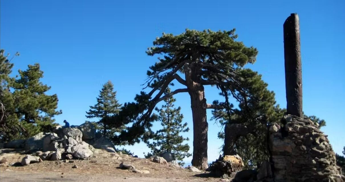
The summit, at 8,073 feet, offers spectacular views. Palm Desert is to the northeast. Desert Hot Springs can be spotted tucked against the San Bernardino Mountains to the northwest. To the southeast is the Anza-Borrego Desert.
Pull out some lunch. Jeffrey pine and white fir grow atop the summit, and there are plenty of great rocks to sit on or flat spots to spread out a tablecloth for a picnic. Or stay the night – there’s a remote campsite atop the summit.
After taking in the views, retrace your steps back to your parked vehicle.
Almost the entire trail is open to the sun, so be sure to don sunscreen, sunglasses and sunhat. Bring plenty of water, Expect the top of the peak to be windy.
Image Sources
- 01-Santa-Rosa-Truck-Trail: Rob Bignell
- Pinyon Pine: Rob Bignell
- Atop Santa Rosa Mountain summit: Rob Bignell


![Enrolling Now, Rewarding Careers Ahead [Sponsored]](https://ukenreport.com/wp-content/uploads/2024/04/COD_heroes_1-1385-2-440x264.jpg)

