Day hikers can explore one of the few waterfalls in the Coachella Valley and a variety of historic Indian sites on the Tahquitz Canyon Trail.
The 1.8-mile trail on the Agua Caliente Band of Cahuilla Indians Reservation consists of two connected loops.
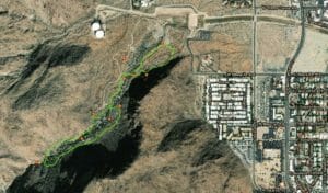
Tahquitz Canyon Trail map
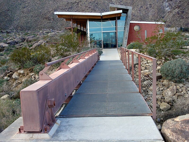
To reach the trailhead, from downtown Palm Springs head south on South Palm Canyon Drive. Turn right/west onto West Mesquite Avenue. Park at the Tahquitz Canyon Visitor’s Center.
A short stem trail heads west from the center to the first loop. When the trail splits, go right/northwest.
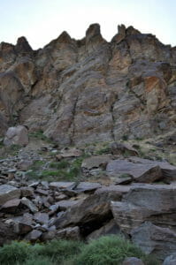
The trail heads through lower Tahquitz Canyon, cut by the seasonal Tahquitz River.
In about 200 feet, the trail reaches the “Mouth of Tahquitz Canyon.” According to Cahuilla history, their “Great Chief” Evonganet named the canyon more than 3,000 years ago.
The trail diverges in about 400 feet. Going left/southeast allows you to continue the first loop back to the visitor center; instead, go right/southwest onto the connector trail to the second loop.
About 200 feet in on the connector, look for Cow is ic ela, aka “The Fox’s Dress,” a large rock atop a huge boulder. Cahuilla legend says a young maiden possessed the power to turn herself into the rock.
The trail reaches the second loop after about a 1000 feet. Go right-straight/southwest on it.
In 450 feet is the “Place of Wasted Mescal.” These are the remains of the Lebacho-Tahquitz Creek Ditch, which the Cahuilla built in 1830 to bring water from the canyon to their village for both drinking and irrigation.
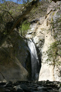
Tahquitz Falls drops 60 feet over a granite slab. The falls is seasonal.
As the second loop reaches its western side, you’ll come to Tahquitz Falls. The 60-foot seasonal waterfall was originally named Pal hani kalet by the leader of the Fox Tribe, which settled in the area more than 2,000 years ago.
The falls is formed where the Tahquitz River flows over a granite slab into a pool. A protrusion on the canyon wall splits the falls.
Viewers of old films may recognize Tahquitz Falls. In 1937, director Frank Capra used it in a scene of Lost Horizon.
The trail then heads northeast back to the connector trail. Just before reaching that junction is Lookout Rock. The overlook offers a view of the Tahquitz Canyon mouth.
The next intersection is the connector trail heading to the first loop. Go right/northeast on it.

After a rainfall, flowers bloom in the canyon.
Once at the first loop, take the trail heading right/southeast. Almost immediately, you’ll see Sacred Rock, the location of one of the Cahuilla’s oldest village sites. Rock art and bedrock mortars more than a thousand years can be seen here.
About 250 feet beyond it is the Piled Boulders, an ancient rock shelter. Artifacts found at the shelter date to the time of Augustus.
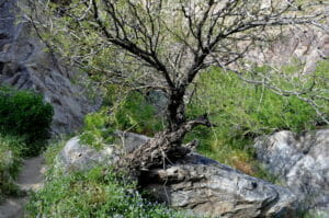
The area of the canyon before the falls is fairly lush, a pleasant respite from the desert.
The next trail junction is the stem leading to the visitor center. Go right/east on it.
Be sure to spend a little time at the visitor center. It features a display of artifacts found in the canyon, an observation deck, and a small theater featuring the brief film The Legend of Tahquitz Canyon.
The trail sports a 350-foot elevation gain and can be steep and rocky in places. Though there are rock steps in many of those spots, they can be 12- to 15-inches high.
The entire canyon is open to the sun, so be sure to don a hat, sunscreen and sunglasses. Also, a fee is charged to hike the canyon, which is open 7:30 am to 5 pm daily through June then only Friday through Sundays from July through September.