Coachella turns to high-tech to help determine street repair needs
COACHELLA — Coachella is upgrading its strategy for assessing street repair needs throughout the city. They have recently adopted AtlasView – an intuitive system that utilizes analytical, high-tech data-capturing software that can predict, with a high degree of precision, the wear and degradation of each individual street throughout the city.
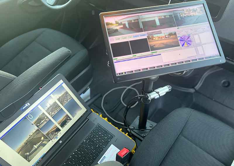
Coachella has collaborated with Michael Baker International to utilize the newest state of the art Pavement Condition Assessment. The city’s assessment will be based on Next Generation Laser Crack Measurement systems, Inertial Profilers, 360-degree spherical cameras, GPS positioning and the latest in computerized control systems to accurately measure the data. The system detects variations in the pavement such as cracks and roughness, and registers distance and measures exact locations.
“This technology is great not only for the accuracy of information collected, but also the level of transparency we are able to offer the community regarding the conditions and paving maintenance of their streets,” said Mayor Steven Hernandez. “City staff will also benefit because AtlasView will also streamline and simplify the assessment and resolution process for our Public Works team.”
Data collected through AtlasView will enable Coachella to develop short and long-term plans for street repair encompassing nearly 150 miles of terrain. Ratings generated from the Pavement Condition Index (PCI) will be published on a public facing webpage that will provide residents with both current and forecasted information regarding street repair throughout the City. The webpage will be linked to Coachella.com and is slated to go live the spring of 2024.
“The City last updated their Pavement Management System in 2016, which involved visual observation of streets and production of a PDF file that summarized the evaluation of the Pavement Condition Index (PCI) and provided recommendations for future maintenance goals,” said Andrew Simmons, City Engineer. “This transition will result in a highly accurate MAP based program that will be fully accessible and transparent to the public and able to be updated annually. The combination of these high tech data collection, data processing and Pavement Management System tools will help guide the City in making financial decisions and investments in street infrastructure and pavement maintenance programs over the next decade and beyond.”
Image Sources
- 2023-Street-Repair-Tehnology-800×568: City of Coachella
![Sheriff & Coroner Now Inseparable [Opinion]](https://ukenreport.com/wp-content/uploads/2026/07/Riverside-County-Administration-Center-440x264.jpg)