At the top of the ridge, the West Fork Trail does continue west for another 4.3 miles
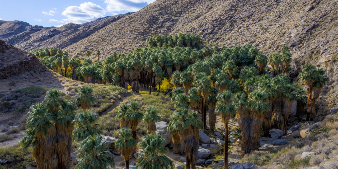
Day hikers can hike to a quiet desert oasis on the West Fork Trail in Palm Springs’ Indian Canyons.
The 5.4 miles out and back trail boasts an elevation gain of 1,581 feet, so you will get a workout. Part of the Agua Caliente Band of Cahuilla Indians famed Indian Canyons area, there is a nominal entry fee.

After several switchbacks up a canyon wall, the West Fork Trail turns to dry desert.
To reach the trailhead, from downtown Palm Springs take S. Palm Canyon Drive south. Upon entering Indian Canyons, when the road splits go left/southeast. The road runs out at the Trading Post where there is parking.
Pickup the Palm Canyon Trail behind the Trading Post. You’ll start in an oasis on Palm Canyon Creek. The largest palm oasis in North America, it’s a spectacular sight all on its own.
At about 0.17 miles, go right/south onto the West Fork Trail. You’ll leave the oasis and switchback up the rocky, bare desert canyon side, which rises from 820 feet above sea level to 1181 feet, which is about 36 stories.
After that, the trail reaches the ridgeline, and though it continues to ascend, the inclines are far more gentle without so many switchbacks.
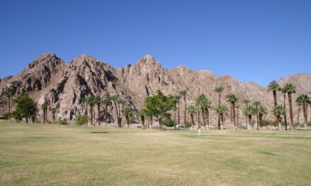
Before continuing on, though, be sure to turn around for the awesome view. Lush Palm Canyon sits below you while below the wash Palm Springs stretches into the distance with the Little San Bernardino’s marking the valley’s other side.
Cactus largely is your friend along the ridgeline, as you enter what appears to be a remote, desolate landscape. The cacti makes for a pretty hike in mid-March when they bloom, though, and if solitude is what you’re after, you’ve picked the right trail.
Indeed, you may find that you’re the only one on the trail. The urban noise of the Coachella Valley, which often is prevalent on either foothill trails, even disappears in this remote section of the Santa Rosa Mountains.
As you ascend, San Jacinto Peak rises above you to the west, making for a impressive view.
Be sure to also take a gander on either side of the ridgeline. Streams run along both sides, and you’ll find stretches of green in each one. The stream on the right is West Fork Palm Canyon Creek, which the trail is named for.
At 2.35 miles, a spur branches to the left/southwest. Skip the spur and instead continue right/northwest and descend into West Fork Palm Canyon.

Several interesting rock formations also can be seen along the trail.
A small oasis sits at the canyon bottom, which is about 2160 feet elevation. The stream running through it is tranquil, and if you arrive in early spring will probably see wildflowers. It’s a great place for a picnic
At 2.7 miles, the intersecting Coffman Trail comes in from the north. This marks a good spot to turn back. At the top of the ridge, the West Fork Trail does continue west for another 4.3 miles with a total elevation gain of 4000 feet from Palm Canyon.
Between the two oases, the trail lacks any shade, so be sure to don sunscreen, sunglasses and sunhat as well as bring plenty of water. Due to the desert heat, do not hike the trail in summer from late May through September.
Note: Don’t confuse this route with the similarly named West Fork Falls Trail, which leaves from the west side of the Trading Post’s parking lot. That trail does not enter the Palm Canyon oasis.
Image Sources
- photo-2-after-several-switchbacks-up-a-canyon-wall-the-west-fork-trail-turns-to-dry-desert.: Rob bignell
- The hike begins at the largest palm oasis in North America.: Rob Bignell