Autumn leaves can be enjoyed along Horsethief Creek on the Cactus Spring Trail.
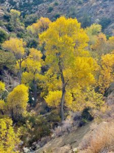
Autumn leaves can be enjoyed along Horsethief Creek on the Cactus Spring Trail.
Coachella Valley day hikers can enjoy fall colors in the Santa Rosa Mountains on the Cactus Spring Trail.
The 5-miles round trip hike to Horsethief Creek sports a 900 feet elevation gain in the Santa Rosa Wilderness section of the San Bernardino National Forest. It’s best-done October to May with fall colors at their peak in November.
To reach the trailhead, from Calif. Hwy. 111 in Palm Desert, go south onto Calif. Hwy. 74 (the Pines to Palms Highway). Drive about 16 miles to Pinon Flats Trans Sta Road; you’ll see a turn sign for the Sawmill Trailhead. Head left onto the road and in 0.25 miles go left again into the parking area.
From the parking lot, walk east down the dirt road crossing Little Pinyon Flat (note that the spelling for the flat and nearby Pinyon Flats Campground is different than that for the road). This is the Sawmill Trail (7S05). You’re at about 4000 feet above sea level.
The trail next reaches a larger dirt road, shown on some maps as Pidgeon Springs Road. Go right/south onto it and head up the mountain.
Take the next left onto Spur A (7S05A) of the Sawmill Trail. It soon forks; go left/southeast onto the narrow path. This is the actual Cactus Spring Trail.
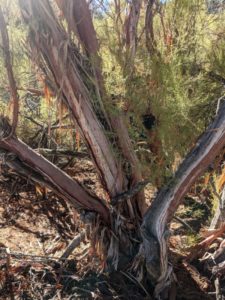
Ribbonwood populates the slopes leading to Horsethief Creek.
It soon reaches a grove of pinyon pine with plenty of beavertail and prickly pear cacti between. California fuchsia and matchweed bloom here in fall. Agave and yucca also thrive.
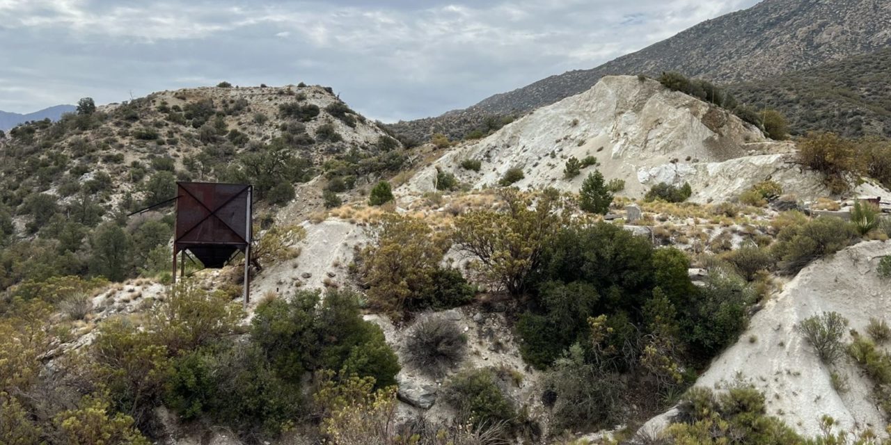
At about 0.6 miles, the trail enters the remains of an abandoned dolomite mine. The ground is still white from the operation, which ran during the 1950s through the 1960s. If you see a home in the Coachella Valley built in the mid-20th century and with white rock roof, there’s a good chance that the stone came from this mine.
You can go off trail to explore the site, though there’s not much in the ways of ruins. However, the ribbonwood and willow trees in Horsethief Creek below the mine site is a pretty, especially when the sun hits it just right after sunrise and during sunset.
Common in California’s chapparal, ribbonwood’s deep roots help stabilize the slopes. A multi-trunked tree, it looks like a shrub and can reach up to 33 feet high. Its red peeling bark is quite striking. It sometimes is called redshanks.
The arroyo willow also is common across California. A native tree, it can thrive in a number of wet, marshy areas in whatever environment they may be found, from sage scrub of deserts to the oak or pine woodlands of higher elevations. Its lance-shaped leaves can reach up to six inches in length and turn yellow in fall.
Continuing east, the trail heads up and down, though more the latter than the former. Martinez Mountain fills the horizon. It tops out at 6566 feet.
This can be a rocky portion of trail. If rain has fallen in March, several shallow streams can wash over this section of the trail, so beware of slippery rocks. The upside is the area also will be lush with green thanks to the runoff.
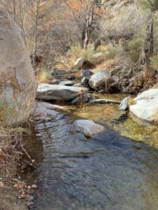
Horsethief Creek has been a popular source of water for the Cahuilla and later cowboys.
In about 2.1 miles, look to your left. Slightly downhill are the remnants of an old corral constructed from dried manzanita. Cowboys used to keep their herds penned here to take advantage of the water supply from Horsethief Creek.
The trail long precedes the cowboys, though. Much of it is an ancient Cahuilla route through Martinez Canyon to Cactus Spring. They considered the spring sacred.
Next the trail heads to a rise above Horsethief Creek. Trees line the waterway for almost a mile. In autumn, their leaves turn bright yellow, a nostalgic scene for transplanted Midwesterners and New Englanders who miss the fall colors.
Among the trees is Fremont cottonwood. Found alongside many of California’s river and streams, under ideal conditions it can reach up 115 feet high and 5 feet around. Their leaves, vaguely shaped like a spade on a playing card, shimmer in the wind. The leaves turn a soft yellow then beige in autumn.
Also beside the stream is the Western sycamore. It can grow as high as the cottonwood, but usually tops out at 80 feet with a trunk a little more than yard around. The bark is particularly beautiful, featuring white, pinkish gray and pale tan colorations. Its huge leaves are perfect for fall color lovers, turning yellow and orange.
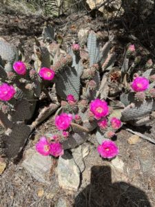
Beavertail cactus bloom during spring and summer following a rainfall.
Once the trail reaches the creek, you can go off trail and walk alongside the waterway for up to another a mile. This adds 2 miles round trip to the hike
Alternately, you can continue for another 2 miles to Cactus Spring, though the trail is not well-maintained pass the creek and the spring can be difficult to spot. This adds 4 miles round trip to your hike.
Whichever endpoint to the trail you choose, once you reach it simply retrace your steps back to the parking lot.
Much of the trail is unshaded, so you’ll want to don sunscreen, sunglasses and sunhat.
Image Sources
- The trail passes through a dolomite mine from the 1950s-1960s.: Rob Bignell

