Bighorn sheep, twisted rocks abound on Magnesia Springs Canyon Trail
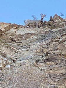
Bighorn sheep often can be seen on the Magnesia Springs Canyon Trail in Rancho Mirage.
Hikers can see bighorn sheep and fantastic geological shapes on a trail into Rancho Mirage’s Magnesia Springs area.
The 3.7 miles out-and-back Magnesia Springs Canyon Trail sports at a maximum of 449 feet elevation gain in the Santa Rosa and San Jacinto Mountains National Monument. It crosses an area sometimes referred to as Magnesia Falls. This trail is only accessible between Sept. 30 and Jan. 1 and then from 6 a.m. to 9 p.m.
To reach the trailhead, from Calif. Hwy. 111, in Rancho Mirage turn south onto Mirage Road. Leave your vehicle at the lot for Blixseth Park. Head south on the sidewalk along the park’s west side. The opening section of the route is popular with trail runners.
At 0.1 miles, cross the bridge over the Magnesia Storm Channel going northwest. Once the trail traverses the wash, turn left/southwest and stay on the single track paralleling it. Be careful not to head west into the foothills.
The wash and canyons may look barren, but a surprising number of plants and animals live here. Creosote, nine types of cactus, and 93 annuals have been identified here and deeper into the canyon. Bell’s vireo, the prairie falcon, and the southwestern willow flycatcher also make their home here, especially during the summer.
The trail at about 0.4 miles follows the narrow space between the foothill and waterway with Porcupine Creek Golf Club on your right/east.
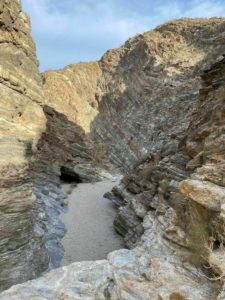
The Magnesia Springs area includes three narrow canyons.
About 1.15 miles in, the trail gets tricky. You’ve reached the impoundment area to control flooding from Porcupine Creek and other mountain runoff channels. If rain is forecast or has fallen during the past 48 hours, don’t go any further. Otherwise, head down the angled concrete wall into the dry reservoir. Once you do that , you’ve entered the Magnesia Spring Ecological Reserve.
From there, you’ve got two options – go left/south directly into a canyon or head right/southwest up a short earthen dam wall into another wash.
The route to the left typically is the way shown on trail maps. You can go farther than the other option, but the trail will be rockier.
For most of the way, the canyon walls rise steeply above you. The turnaround point is at 1.87 miles when the ascent hits too steep of a wall to climb over.
Heading right back at the impoundment takes you through a wash so will be sandy. Its end points are a bit more dramatic, however.
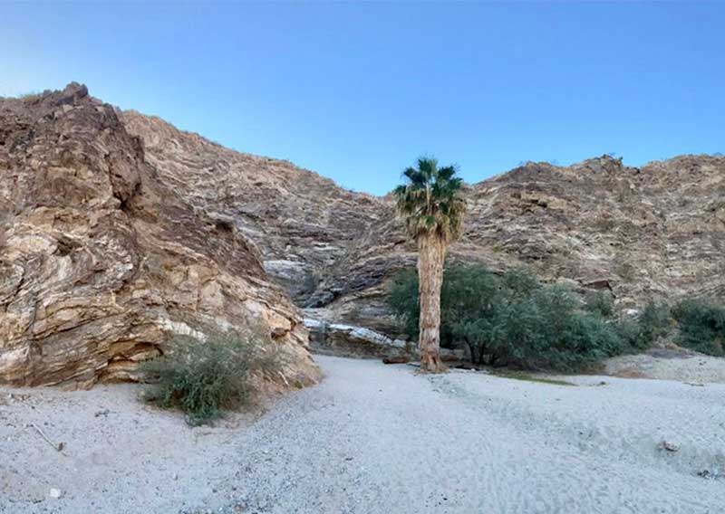
After cresting the earthen dam wall – take the trail on the canyon’s right/south side to prevent erosion – a wide wash splits. Going left/south takes you to a palm tree with a rock wall you can scramble up into a narrow canyon. In one turn, though, a much higher rock wall blocks you from going further.
Head right/northwest, though, and you can make a feel more turns into the increasingly narrow canyon before hitting the same too-tall-of-a-wall obstacle. The trail ends at a small cave-like undercut in the rock, created over the centuries by the splash of flowing water down the steep walls into the canyon.
The two great sights to see in the three canyons are peninsular bighorn sheep and twisted rock layers.
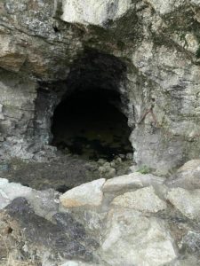
Erosion has hollowed out narrow caves behind usually dry waterfalls.
While bighorn sheep aren’t always present, keep an eye out for them standing on the mountainside above you. They blend in quite well with the tawny landscape, but their size gives them away when they move.
Adult rams can weigh between 150-200 pounds – as much as a full-grown man – and ewes usually are 100-125 pounds. The adult ram’s horns sometimes reach 30 inches each in length and at the base are 15 inches in circumference.
Bighorn sheep often can be seen feeding on acacia, encelia, krameria and sweetbush, but they will adapt their diet to what’s available. During summer, the ecological preserve is a vital water source for the sheep.
These foothills – as well as the other peaks in the Santa Rosa and San Jacinto Mountains National Monument – began to form about 150 million years ago during the Jurassic when the North American tectonic plate began to ride over the Pacific plate. The buried plate, under great pressure and heat, turned to molten magma that slowly rose, mixing with and morphing the sedimentary layers above. This created the mahogany-colored rock seen today in the mountainsides from Palm Springs to Palm Desert.
About 50 million years ago, under continued tectonic pressure, the land crumpled and pushed up the mountains we see today from the Santa Ana Mountains near Riverside to the tip of Baja California a thousand miles away. Erosion has stripped away some of the sediment covering the rocks, exposing them. In Magnesia Canyon, many are bent at odd angles or form odd, interesting shapes, such as several layers making an S shape in the canyon wall.
There’s no shade at all on the trail, so be sure to don sunscreen, sunglasses and sunhat. You’ll want to wear quality hiking boots and carry a trekking pole for the portion of the hike past the impoundment area. Dogs are not allowed on the trail.
Image Sources
- Upended and twisted rock layers: Rob Bignell

