Day hikers can walk the northern edge of the Indio Hills on a lollipop trail near Desert Hot Springs.
The 5.6-miles round trip trail crosses a badlands topography in the Edom Hill Conservation Area. It opened in March 2018. A sandy trail, the hike is best done on windless days.
 To reach the trailhead, from the intersection of Palm Drive and 20th Avenue (north of Interstate 10 near the Desert Dunes Golf Club), go east onto 20th Avenue. At Mountain View Road, turn right/south then take the next left/east onto 20th Avenue. When the road splits, follow it left/north onto Corkill road. The dirt parking lot is the very next right/east. Look for the trailhead in the lot’s southeast corner.

After rainfalls, desert wildlfowers can be spotted on the Kim Nicol Trail.
The trail’s stem initially crosses the desert floor. If hiking in spring or within a couple days after a rainfall, you’re likely to spot wildflowers along the way
At about 0.57 miles, the trail enters the Indio Hills. You’re at 984 feet elevation and will start climbing. The trail reaches a height of just over 1500 above sea level.
While the Indio Hills are best known for a series of oases that grow near Thousand Palms, the low-lying hills actually touches a number of Coachella Valley communities. It stretches 20 miles from the southeast corner of Desert Hot Springs to the northeast side of Indio and is about three miles wide.
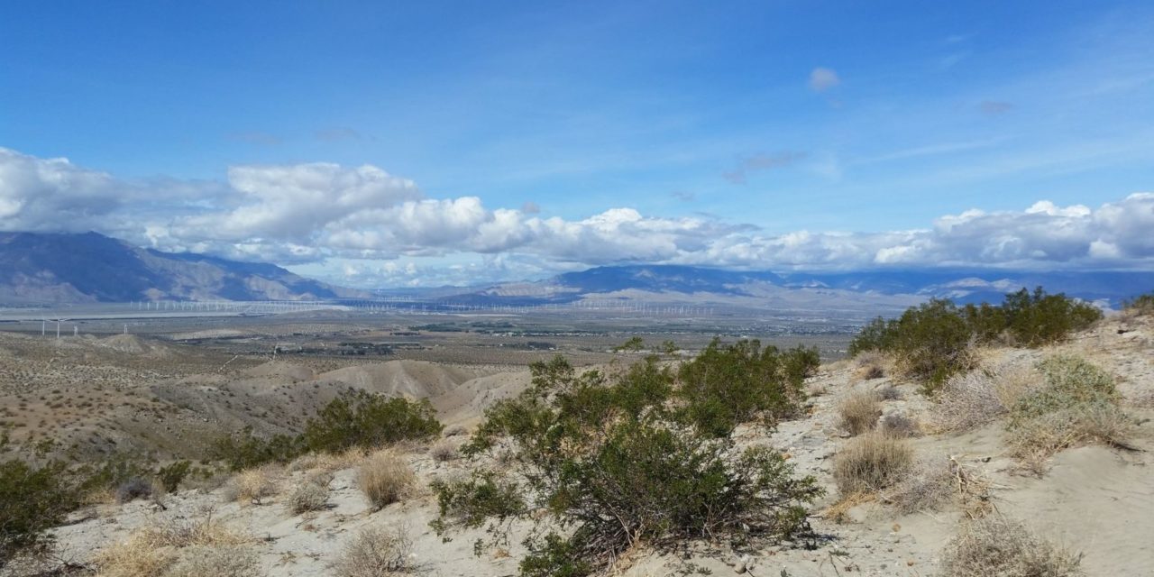
At 0.85 miles in, the stem reaches the loop. Go right/south. In winter, you’ll be treated to great views of snow-covered San Jacinto Peak and surrounding mountains with the windmill farm at their base.
On the loop’s south side as Merganzer Road ends below you, look directly south for Edom Hill. Rising to 1610 feet, prominent hill is easy to spot, not only for its height but the communication towers on it. The hill often is incorrectly referred to as a sand dune. Wind from the San Gorgonio Pass often blows sand into the hill’s depressions and along its base, so it somewhat looks like a dune.

The Kim Nicol Trail traverses the Indio Hills’ badlands topography.
The Kim Nicol Trail can prove to be a good workout challenge, as there are some steep switchbacks on sand. Still, the Indio Hills’ northern end typically rises only about 600 feet above the valley floor while the southern end can top out at 1200 feet, making for an easier hike near Desert Hot Springs than Indio.
As with the most of the Indio Hills, the coarse, gray rock here is quite young at less than 2.6 million years old. Since the rock is poorly consolidated and sandy, it easily erodes during torrential rains. The result is a maze of gullies with sharp ridges. The arroyos typically are V-shaped with flat sandy bottoms.
Faults along the San Andreas Fault created the Indio Hills by raising the land between them into an arch. The Banning Fault – thought to be the main San Andreas Fault – runs along the hills’ southeastern face that is seen from Interstate 10. The Mission Creek fault sits on the hills’ north face.
The loop’s north side runs alongside the Mission Creek Fault. On this part of the hike, you’ll enjoy great views of Fun Valley below and of West Wide and East Wide canyons cutting into the Little San Bernardino Mountains beyond.

Snow-capped mountains rise above the Kim Nicol Trail near Desert Hot Springs.
This side of the Indio Hills is a sort of valley within a valley. Called the Dillon Road Piedmont, the plain rises as approaching Indio. The piedmont’s floor consists of sand and rock washed off the Little San Bernardinos. Because there is insufficient rainfall, it has accumulated to several hundred feet deep. Sky Valley (visible from the trail) and the community of Indio Hill farther southwest sit atop the piedmont.
At 4.7 miles, the loop reaches the stem. Go right-straight/northwest onto the stem and retrace your steps back to the parking lot.
The trail is named for longtime Coachella Valley resident and biologist Kim Nicol. She played a major role in the development and passage of Coachella Valley Multiple Species Habitat Conservation Plan. She passed away in 2015 from cancer.
Be forewarned that this trail is poorly marked, so carry a map and compass before going on it. Not an iota of the route is shaded, so always don sunscreen, sunhat and sunglasses. Bring plenty of water. Dogs are allowed on trail but must be leashed.
Image Sources
- Desert wildlfowers: Rob Bignell
- Snow-capped mountains: Rob Bignell
- Views from Kim Nicol Trail: Rob Bignell