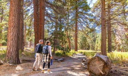
Day hikers can head to the base of one of Indian Wells’ iconic peaks on the Eisenhower Mountain Trail.
The 4.3-miles round trip actually is a collection of three trails – a stem and two stacked loops – that sits in both the Living Desert Zoo and Gardens’ 360-acre nature preserve and the San Jacinto-Santa Rosa Mountains National Monument. Storm damage temporarily closed the trail in winter 2018-19, but it since has reopened.

Eisenhower Mountain seen from the trailhead at the Living Desert Zoo and Gardens rises to nearly 2000-feet.
Though the mountain and the trail are in the Indian Wells city limits, the best way to access the route is via a trailhead in neighboring Palm Desert at the Living Desert Zoo and Garden. To reach the trailhead, from Calif. Hwy. 111 in Palm Desert, turn south onto Portola Avenue. Park at the Living Desert Zoo and Gardens on the road’s left/east side. An entry fee is required.
You’ll get to explore a little of the Living Desert Zoo and Gardens. The trailhead is at the facility’s northern edge on the north side of a spur jutting out of the foothills. The hike starts at about 320 feet elevation.
The trail quickly splits to form the western end of the first stacked loop, which is known as the Adventure Loop. Go left/northeast onto the trail so that you take the route clockwise.

Yucca grows in the desert scrubland along the Eisenhower Mountain. Trail.
You’ll cross a desert riparian woodland. Scrubland surrounds the path, but after a rainfall it comes alive with the color of desert wildflowers.
The trail next passes over a desert wash or arroyo. In doing so, the trail dips and briefly becomes quite sandy.
East of the wash, the trail reaches the western segment of the second loop, the Wilderness Loop. Go left/north onto it. The route starts to gain elevation, as it heads up a desert mountain ridge.
The trail’s eastern leg is its high point, specifically a picnic shelter at close to 1000 feet elevation. This offers a fantastic view of Eisenhower Mountain, which tops out at 1952 feet.
While a mountain by Minnesota or Maine standards, in California it’s really just a steep foothill.

Eisenhower Mountain is a prominent peak on the Indian Wells skyline.
Still, it’s a prominent peak in the foothills above Indian Wells, dominating the southern skyline beyond the Eldorado Country Club.
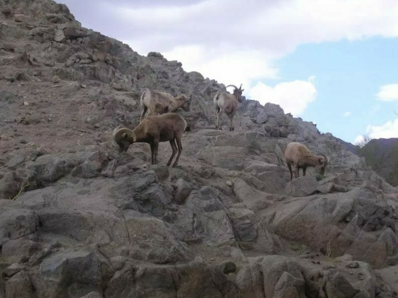
Once taking in the sights, begin the return leg to the Living Desert Zoo and Gardens. The trail back descends through a rocky desert draw. The path narrows and requires a little boulder scrambling. This is a good section to spot rare bighorn sheep.

San Jacinto Peak, as seen from foot of Eisenhower Mountain, is about 15 miles away.
The return trip offers great views of Indian Wells to the north and northeast and Palm Desert to the northwest. Looking west, you can see the summit of San Jacinto Peak which rises over Palm Springs about 15 miles away.
Along the way down, the trail passes Hidden Valley on the left/south, a built-up area on a low saddle in the spur coming out of the foothills.
Once past Hidden Valley, the trail junctions with the eastern loop of the Adventure Loop. Go left-straight/west onto it.
Just before reaching the loop’s stem, take a side trail to the left for an interpretive exhibit about the San Andreas Fault. There’s a great view of the fault, which sits on the valley’s other side, running in a line just north of Indio to just south of Desert Hot Springs.
An alternate trail to Eisenhower Mountain’s summit runs from Eldorado Country Club. but the route is extremely steep and partially runs up draws.
As there is little shade except the foothills’ shadow, be sure to don sunsceen, sunglasses and a brimmed hat for the hike. Bring plenty of drinking water as well. The trail is open only from October 1 to May 30.
Editor’s Note: There are four maps for the trail; since it heads through a lot of foothill spurs, to show the terrain multiple maps are used to show readers.

Eisenhower Mountain Trail Map Plate I

Eisenhower Mountain Trail Map Plate II

Eisenhower Mountain Trail Map Plate III

Eisenhower Mountain Trail Map Plate IV
Image Sources
- Eisenhower Mountain: Rob Bignell
- Eisenhower Mountain Trail: Rob Bignell
- San Jacinto Peak: Rob Bignell
- Eisenhower Mountain Trail: Rob Bignell