Coachella Valley day hikers can explore a transition zone between two mountain forests on the Panorama Point Trail in Mt. San Jacinto State Park.
The 1-mile loop to a scenic viewpoint is a perfect hike for those looking to escape the desert heat or those taking a day trip to Idyllwild. During late summer, morning temps usually are in the mid-60s with highs reaching near the 80s around noon.
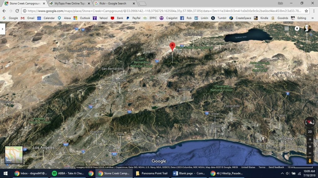
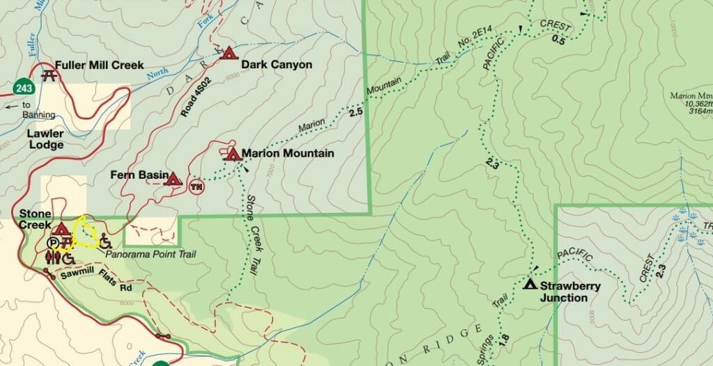 To reach the Panorama Point trailhead, for those living in the northern Coachella Valley, take Interstate 10 west over the San Gorgonio Pass. In Banning, turn left/south onto Calif. Hwy. 243. From Palm Desert and all points south in the Coachella Valley, take Calif. Hwy. 74 (the aptly named Palms to Pines Highway) into the mountains. At Mountain Center, turn right/north onto Calif. Hwy. 243. Both routes lead to Forest Route 4S02; turn north onto it into the Stone Creek Campground. At the next two intersections in the campground, veer right and look for the small parking lot on the right/south.
From the parking lot, walk northeast on the campground road, staying right at each junction.
Once you reach the road’s east side, watch for the Panorama Point trail sign and turn right/east onto the dirt but extremely well-graded path.
Stone Creek Campground sits at roughly 6000 feet, so you’re more than a mile above the Pacific Ocean. This area of the San Jacinto Mountains is a transition zone in the forests.
The lower forest largely consists of manzanitas and black oak, which thrive on the drier, hotter slopes. You’ll also find fragrant ponderosa and Coulter pines.
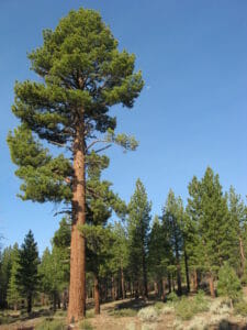
While ponderosa pine is widespread across the western United States, there are several subspecies and varieties. The type in Southern California sticks to mountain ranges and can be found all along the Pacific Coast north through Oregon and in the Sierra Nevada. The California species boasts the longest needles, which sometimes measure nearly eight inches.
Regardless of the subspecies or variety, all ponderosa pines are easy to identify by their bark color. Younger tree sport a very dark brown bark and so were nicknamed blackjacks by loggers. As the tree matures, its bark turns yellow to orange-red and appears in broad plates with black crevices between them.
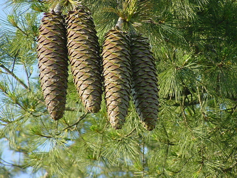
Coulter pines are common in Southern and Baja California, but its numbers are decreasing. Its spiny cones are the largest of any pine species, usually between 8 to nearly 16 inches long and weighing up to 11 pounds. Foresters working in Coulter pine groves call them “widowmakers” for good reason! You will see these on Panorama Point Trail.
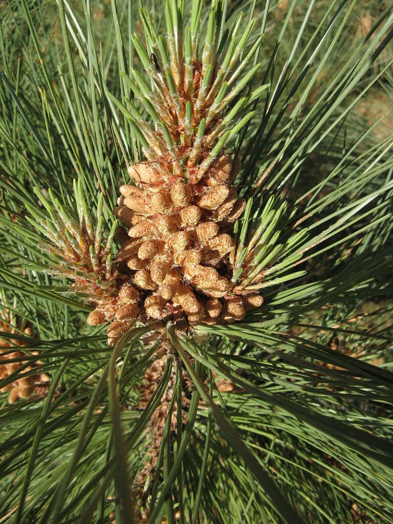
Jeffrey pine is a common sight in the higher forests of California’s mountain ranges.
The higher forest boasts two other common California mountain trees – sugar and Jeffrey pines.
Sugar pines are the tallest and largest of the pines, growing up to 195 feet high with a trunk diameter of 4 feet 11 inches to 8 feet 2 inches. Under the right conditions and if given enough time, they can grow much larger; the tallest recorded one at 273 feet 9 inches was discovered in 2015 at Yosemite National Park. Their slender cones also can grow longer than the Coulter pines (but don’t weigh as much). No wonder naturalist John Muir nicknamed them the “king of the conifers.”
Sugar pines got their name, however, from their sweet resin. Native Americans for centuries used the resin as a sweetener, and Muir even preferred it to maple sugar.
Jeffrey pines – aka as Jeffrey’s pine, yellow pine, or black pine – usually grow at an elevation of 5,900 feet to 9,500 feet in this part of its range, and can be found from Baja California to Oregon. The higher the elevation, usually the shorter and slimmer the tree.
Because the Jeffrey and ponderosa pine are closely related, their appearance is often confused, especially when they mix as they do on this trail. One good way to tell them apart is to look at the cone. If the barbs point inward so that the cone feels smooth in your hand, you’ve got a Jeffrey pine. The ponderosa pine’s barbs point outward and will feel like you’re holding needles if in your palm. Just remember this common memory device – “gentle Jeffrey and prickly ponderosa.”
Making their homes amid and below these various trees along the trail are chickadees, squirrels and plenty of harmless lizards.
Beyond the trees, 10,834-foot San Jacinto Peak looms on the northern horizon. If facing the summit so that it’s at 12 o’clock, Palm Springs would be at the 1 o’clock position on the peak’s other side.
Another highlight of the trail is Panorama Point, which looks south to Hemet, Menifee, and Lake Elsinore on the plain below. On a clear day, you can see the Pacific Ocean.
While the chickadees and slight breeze rustling through the pines provides an impressive soundtrack to the hike to Panorama Point, you can download an audio tour of the trail to play on your portable media player. Created by the state park service, the mp3 format files can be found here.
Since the loop runs through a state park, there is a nominal fee for day-use. Dogs are allowed if on leash. And while the trail is dirt, it is level and packed so well that it has been deemed wheelchair accessible.
Final note: Don’t confuse this route with the mountain biking trail of the same name off of Interstate 10 in Redlands.
The male cone of the Coulter pine a common California mountain tree seen on the Panorama Point Trail.
The expansive view of Panorama Point at Stony Creek Campground look south to the Pacific Ocean.
![Healthy Desert, Healthy You [Sponsored]](https://ukenreport.com/wp-content/uploads/2026/07/2026-v2-Takaahi-Wada-Angelica-Geter-800x568-1-440x264.jpg)