As the trail switchbacks up toward the Desert Divide, evergreens rise around you.
One of the best ways to escape the desert heat is to gain some elevation. Fortunately, a number of nearby trails do just that by heading to the Desert Divide, a ridge connecting several peaks south of Mount San Jacinto.

The 2013 Mountain Fire left behind the husks of scrub oak along the trail.
The 12-mile round trip Spitler Peak Trail (3E22) is one such trail. Be aware that due to the 2013 Mountain Fire, the trail has been reworked, so older topo maps of the route are inaccurate.
From Palm Desert, take Calif. Hwy. 74 into the mountains. Turn right/east onto Apple Canyon Road at Hurkey Creek. Park in a turnout about 150 feet before reaching the trail. Walk along the roadside north to the trailhead, which goes right/east from the pavement.
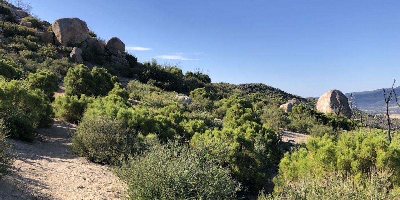
The trail starts in Garner Valley’s chaparral country at about 4920 feet elevation. The first mile is relatively flat with the second mile a gentle ascent.
Chamise is the most common shrub in the lower chaparral region. The flowering plant reaches up to four-feet high with a number of stick-like branches. Its highly flammable leaves are oily, hence its nickname greasewood. Related to roses, the plant does well in Southern California’s foothills, as its wide spreading and deep penetrating roots securely anchor it.
A little higher up, manzanita appears. Taller than chamise, the manzanita shrub’s strikingly red branches usually reach about six feet. It begets small pink flowers in spring. Dozens of manzanita species exist, with some limited to very specific areas, such as Orange County or the Sonoma area.

As nearing the Desert Divide, the chaparral gives way to tall evergreens.
At mile three, the ascent grows increasingly steep. Here it runs through the oaks section of the chaparral. The Mountain Fire left nothing but charred trunks of the oaks that grew here, leaving behind an eerie landscape. Desert scrub plants, however, are slowly filling in the understory.
Most of the burned out trees were various species of scrub oaks, which can reach 13 feet high. Their dull green leaves are waxy on the top and hairy underneath, an adaptation to the dry, hot climate.
As the trail switchbacks up toward the Desert Divide, evergreens rise around you. Incense-cedar, western juniper, white fir, and pines including foothill, Jeffrey, sugar, are inhabit the divide’s top. The green contrast with the chaparral below is quite stark.
At 7000 feet, the trail reaches Desert Divide. The Pacific Crest Trail runs along the ridge top.
Looming above to the south is Spitler Peak. At 7440 feet elevation, it’s the fifth highest of the dozen peaks on or near the divide. Red Tahquitz Peak is the tallest at 8720 feet while Butterfly Peak is the shortest at 6240 feet.

A number of fascinating rock formations can be seen along the Spitler Peak Trail.
You can scramble and bushwhack to the top of Spitler Peak, but it’s not recommended unless you are in excellent physical shape and familiar with backwoods navigation. The top offers an excellent view of the entire Coachella Valley to the north and Lake Hemet to the south.
Alternately, you can take the PCT south to partially wrap around the peak. This provides some good vistas of the Coachella Valley.
After taking in the peak, retrace your steps back to the trailhead.
Much of the trail is exposed to the sun, so be sure to don sunscreen and sunhat as well as bring plenty of water.
Image Sources
- The opening two miles: Rob Bignell