Hike Frank Bogert Trail to Murray Hill
Day hikers can traverse the foothills between Palm Springs and Cathedral City on the Frank Bogert Trail to Murray Hill route.

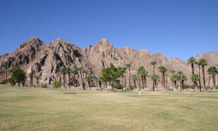
The Frank Bogert Trail begins in Palm Canyon.
The 6.8 mile round trip trail gains 1,853 feet in elevation. It’s a good alternative to the Garstin Trail route to Murray Hill, as the elevation gain is spread out and not as severe at the trailhead.
October to April marks the best time to hike the trail, as the summer heat will be unbearable. From mid- to late-March, wildflowers and cacti bloom along the trail.
To reach the trailhead, from downtown Palm Springs take South Palm Canyon Drive south of Calif. Hwy. 111/Palm Canyon Drive. Turn left/east onto Bogert Trail. When the road becomes Andreas Hills Drive, go straight-right/northeast onto the dirt road that leads to the parking lot for the Frank Bogert Trailhead. The trail goes southeast from the lot.
Before taking the trail, though, follow the road north. Step onto a side trail to the left of the road – which heavy rains washed out in 2017 – and you’ll be treated to a great vista of Palm Canyon.
Heading southeast from the lot, the trail winds around a foothill, slowly gaining elevation. As there are a number of intersecting trails, you definitely will want to bring a topo and maybe an aerial map of the route so that you don’t lose your way.

Frank Bogert Trail to Murray Hill topo map
If at about 1.25 miles you can see two round water tanks to your left/north and are beginning a series of switchbacks heading up and northwest, you’re going the right way.
Once atop the switchbacks, the trail generally flattens.
The trail descends into a saddle at 1.8 miles.
Next the route junctions at 2.2 miles with the Wildhorse Trail, which spreads out like a U to the north. You’re going south, however, up a steep ridge. It’s almost all uphill from here. In addition, the trail narrows as nearing the top.

Nice views of San Jacinto Peak await on the Frank Bogert Trail.
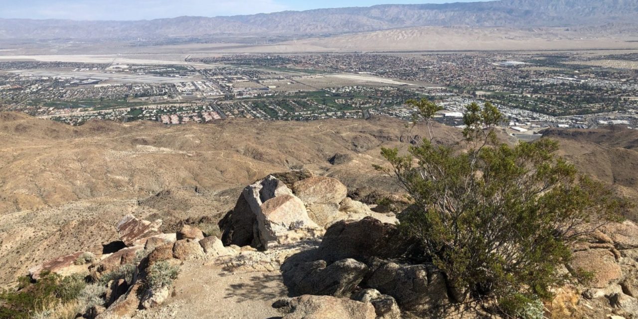
The reward is great views of first Palm Springs then Cathedral City the whole rest of the way. San Jacinto Peak rises to the northwest and Mount San Gorgonio beyond it. The Santa Rosa Mountains are down valley to the south while the Little San Bernardino Mountains are to the east across from the Coachella Valley.
Once at the top of the ridge line, you’ll spot Murray Hill straight ahead on the trail. The trail descends into a saddle than makes a steep climb up Murray Hill’s side to the peak.
You’ll reach the rocky peak of Murray Hill at 3.4 miles. A prominent foothill in the northwest Coachella Valley, it rises to 2200 feet, about 26 stories above Palm Springs and Cathedral City.
A picnic table sits near the peak. Bring lunch and enjoy the vista while. Be sure to pack out what you pack in.
After taking in the sights, retrace your steps to the trailhead.
The trail is named for a former mayor of Palm Springs. specifically Sonny Bono’s predecessor. In 2009 – a year after Bogert died at 99 years old – the trail was dedicated to him.
If you’ve ever driven East Tahquitz Canyon Way in Palm Springs, you’ve probably seen Frank Bogert – a statue of him on horseback stands in front of Palm Springs City Hall.
While Bogert is credited with helping make Palm Springs an international destination, his statements and some organizations he played a key role have been criticized as bigoted and misogynist. This past summer, a petition called for the statue’s removal.
There’s no shade on the trail, so be sure to don sunscreen, sunglasses and sunhat. Hiking boots and a trekking pole are recommended to keep your balance on the narrow ridgeline portion of the hike.
Image Sources
- The Frank Bogert Trail begins in Palm Canyon.: Rob Bignell
- Views of San Jacinto Peak: Rob Bignell
- Great views await on the high ridges that the Frank Bogert Trail traverses.: Rob Bignell