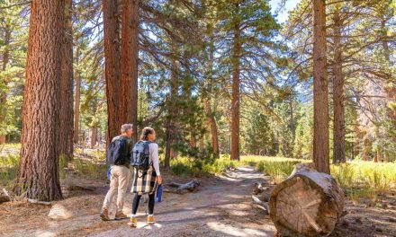
Day hikers can explore one end of Palm Canyon Creek and enjoy great views of Palm Springs, Calif., on the Garstin Trail.
The 3.7-mile lollipop trail mostly sits in the Santa Rosa-San Jacinto Mountains National Monument. It overlooks Palm Canyon Creek the entire way.

Garstin Trail map
To reach the trailhead, from Calif. Hwy. 111 (Palm Canyon Drive) in Palm Springs, go south onto S. Palm Canyon Drive. Turn right/east onto Bogert Trail then left/north onto Barona Road. Park along the roadside when the street dead ends. The trail heads up the embankment on the street’s east side.
An extremely short stem for the trail curls southeast, passes the trailhead to the Earl Henderson Trail (which marks the loop’s start), then switchbacks up the desert foothills to a ridgetop.

Desert scrub and cactus line much of the Garstin Trail.
Palm Canyon Creek is to the trail’s northwest at the foothill’s base. Even when dry, the creek is easy to spot as a narrow dark band surrounded by a wash. While taking in the sights, be aware that there are steep drop-offs along the ridgetop, so watch your footing.
About 1.2 miles in, the trail splits. Go left-straight/northeast.
The creek starts high in the Santa Rosa Mountains above the Coachella Valley and runs much of the length of Palm Canyon. When it hits the desert floor, it curves east and near S. Gene Autry Trail meets Tahquitz Creek and the Whitewater River.
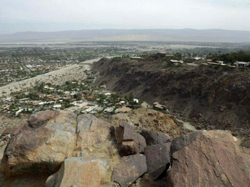
About 600 feet beyond the split, the Garstin junctions the Berns Trail. Go briefly onto the Berns, walking about 300 feet to a high point that’s roughly 90 stories above Palm Canyon Creek. It offers a fantastic view of Palm Springs below and San Jacinto Peak to the northwest. Cathedral City and the eastern Coachella Valley stretch across the northeastern horizon.
After taking in the view, head back onto the Garstin Trail, going right/north. The trail gradually descends.

The Garstin Trail climbs about 90 stories above the Coachella Valley floor.
Higher in the foothills, about 8.1 miles of Palm Canyon Creek is designated a Wild and Scenic River. A vital source of water for endangered Peninsular bighorn sheep, it also feeds the nation’s largest fan palms oasis on the Agua Caliente Indian Reservation. The riparian habitat supports a number of songbirds, including the southwestern willow flycatcher.
At 2.75 miles in, the trail curls southwest and continues its descent to the wash. For much of the trail’s next segment, you’ll walk at the very bottom of the foothills just above the wash.

Lower Palm Canyon Creek and its wash run at the base of the foothills that the Garstin Trail climbs..
Historically, the creek served as the center of Cahuilla culture for more than 2000 years. Its water supported farming and brought to the area animals that could be hunted. The creek was about more than food and drinking water, however; it also played a role in their spiritual beliefs.
At 3.6 miles, you’ll reach the stem. Go right/west onto it and return to your vehicle.
The trail is entirely exposed to the sun, so don sunscreen, sunglasses and a sunhat. Always bring plenty of drinking water and wear hiking boots with good traction.

The Garstin Trail climbs about 90 stories above the Coachella Valley floor.
Image Sources
- Garstin Trail Map: Rob Bignell
- Garstin Trail Offers Great Views Of Palm Springs: Rob Bignell
- Garstin Trail: Rob Bignell
- Garstin Trail Offers Great Views Of Palm Springs: Rob Bignell
- Garstin Trail: Rob Bignell